Silver River Connector

Gushing more than 550 million gallons of water out of a cluster of springs each day, Silver Springs is the birthplace of the Silver River, a wild and scenic waterway that my paddler friends like to describe as “6 miles upstream and 1 mile downstream.” A tangled jungle of floodplain forest edges the meandering waterway as it snakes its way to its conclusion at the northward-flowing Ocklawaha River.
It’s here that the Silver River Connector comes in. Built to showcase a segment of the Cross Florida Greenway paralleling SR 40 – the Florida Black Bear Scenic Byway – it’s a 3-mile round-trip ramble through pine and palmetto flatwoods from the Ocklawaha Visitor Center, a must-stop for information about the Ocala National Forest and the Greenway, to Ray Wayside Park, where paddlers put in to explore from the rivers’ confluence.
LFrom the visitor center, walk back along the entrance road past the volunteer’s campsite and look for a fence line beyond it to the north. The gap in the fence to the right of the kiosk is where this trail begins. A glimpse at the kiosk will show you the trail map, decidedly linear, and confirm your mileage. The trail starts out as a broad path behind shepherded by the fence – which has old interpretive plaques mounted on it – around a curve to the right to encounter an old kiosk with habitat information.
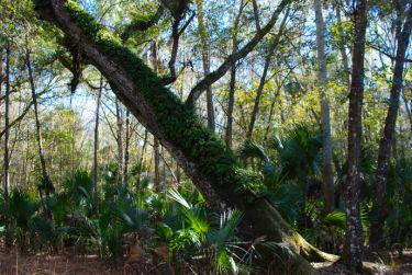
The uniqueness of this particular forest was first documented by steamboat owner R.M. Harper in 1915 as a “loblolly pine/cabbage palm bottom” featuring a mix of pines, oaks, and a profusion of cabbage palms in a damp forest between the rivers. Indeed, after a rain like we had the day before, the footpath fills with big puddles. But it’s a big footpath to start, broad as a forest road, beneath a dense canopy providing full shade even in winter. This forest marks the southernmost edge of many North Florida species, including cedar elm, bluff oak, and box elder.


